VLPROTEUSPLUS - Specification
| General |
| General Features: | Full High Definition Video Overlay
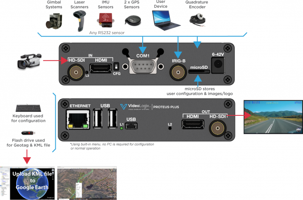
Stand-alone operation i.e. no PC required
Simple user interface for configuring screen via USB keyboard
Overlay data from any GPS modem ($GPRMC, $GPGGA, $PTSAG, etc.)
Overlay data from NMEA 0183 sensors ($GPWPL, $GPGSV, $GPGGL, $SDDPT, $SDDBT, $WIMTW, $WIMWV, $VNINS, $VNIMU, $VNYPR, $PTNTHPR, $HCHDG, $HCHDT, etc.)
Overlay data from NMEA 2000 sensors (PGN 129029, 129025, 128259, 130323, 128267, etc.)
Overlay values from CSV sentences received via RS232, USB, Ethernet
Overlay texts such as user titles, time, date, latitude, longitude, etc.
Jam Sync Timecode with GPS, IRIG, RTC
Overlay PNG & JPG images
Superimpose composite (NTSC/PAL) video input over HD video input (PIP)
Generate KML file with multiple user defined place markers
Built-in Compass and Tilt (Pitch & Roll) sensors
User configurable fonts
Over 30 drawing commands through RS232, Ethernet, USB
Battery backed up real time clock (RTC)
Per pixel alpha blending
1920 x 1080 OSD overlay resolution |
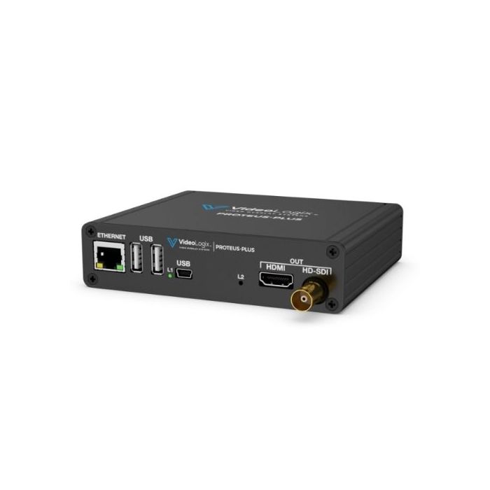
| Video: | HD-SDI input
HD-SDI output
HDMI input
HDMI output
Composite input (Viewable only as PIP over HD video input)
1080i @ 50, 59.94, 60 Hz
720p @ 50, 59.94, 60 Hz
1080p @ 23.98, 24, 25, 29.97, 30 Hz
480i (NTSC), 576i (PAL)
Fast video input to output delay i.e. 0.5 μ |
| Communication Ports: | 2 x RS232
1 x CAN
1 x USB2.0 Device
2 x USB2.0 HOST
1 x Ethernet 10/100 (Static or DHCP IPv4 addressing)
1 x IRIG-B |
| Additional Features: | Analog Inputs: Convert analog inputs to speed, depth, pressure… 2
Quadrature Inputs: Convert count to distance, speed…
Supported Devices: GD Cineflex, Bar code scanners, VectorNav GPS/INS, Smartmicro radar
Apps: XY Measurements, Reticle, Rov situation awareness, Aerial situation awareness, Count up/down timer
Graphics Widgets: Slider, Compass
Generate KML for Google Earth: Geotag, Georefer |
| Design + Dimensions: | Box Dimensions (mm) 125 x 106 x 30
Weight (1lb)
Power (6-42VDC, 4W)
2-year warranty
Operating Temperature Range: 0-65° |
|


 Arabic (UAE)